cellular-Radio
📊 cellular-Radio Dataset
![]()
![]()
📖 Introduction
The cellular-Radio Dataset is a hybrid dataset tailored for 3D Radio Environment Map (REM) construction which combines collaborative air-ground empirical measurements with Ray-Tracing (RT) simulations conducted over identical real-world topography.
🛠️ Data Acquisition & Simulation Setup
1. Empirical Measurements
- Scenario: Yunnan University’s Chenggong Campus, representing a typical suburban propagation environment.
- Measurement Platform: A DJI Air 3S utilized as the aerial platform for high-altitude spatial sampling.
- Receiver Equipment: A commercial smartphone equipped with a Snapdragon X70 5G modem (Qualcomm Incorporated, San Diego, CA, USA) was deployed to continuously record RSRP variations via the Cellular Pro application (alibaba1126, Beijing, China).
- Center carrier frequency: 3.45 GHz
- Channel bandwidth: 100 MHz
- Sampling speed: 3 m/s
- Sampling interval: 0.5 s
2. Ray-Tracing Simulation
Environment Modeling: 3D building meshes and topography were reconstructed utilizing Esri World Imagery and JAXA AW3D30 DEM.
- Coordinate Reference System: The dataset uses WGS 84 (EPSG:4326) for global coordinates and is projected to UTM Zone 48N (EPSG:32648) for local 3D simulations.
- Simulation engine: NVIDIA Sionna (v2.0.1)
- Antenna Pattern: Compliant with 3GPP TR 38.901 specifications.
- Grid resolution: 1 m
- Maximum Depth: 5 reflections / diffractions
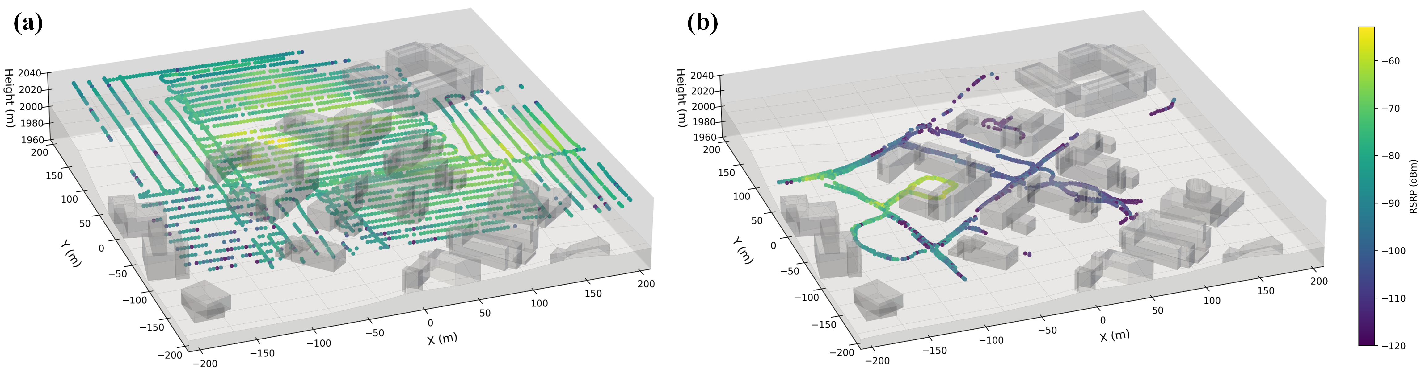
🖼️ Measurement Data Visualization
Spatial distribution for PCI_21 of: (a) UAV data; (b) Ground-level data.
📁 Repository Structure
```text ├── Dataset/ │ ├── 3D-VRM/ │ └── Joint-REM/ ├── Sionna/ │ ├── REM/ # Jupyter Notebook for data simulation │ └── YNU/ │ ├── meshes/ # 3D Geometry Mesh include (.ply) │ └── YNU_scene.xml # Scene Description ├── Assets/ │ └── PCI_21.png/ # Measurement Data Visualization for PCI_21 └── README.md